Submitted by Anonymous on Thu, 01/12/2022 - 12:08
New UAV-based system enables efficient forest restoration monitoring
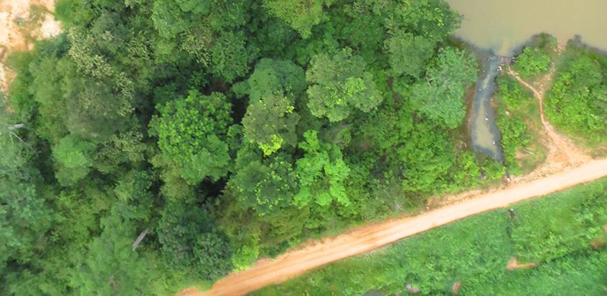
Ecologists at the Conservation Research Institute have developed a new method of mapping early successional species in tropical forests using Unoccupied Ariel Vehicles (UAVs) to generate reference crown images with attached GPS, a system that will enable practitioners to construct reference data sets for forest restoration projects more efficiently and effectively.
Millions of hectares of tropical forest are logged or damaged by fire each year, and the United Nations has the decade of ecosystem restoration in recognition of the urgent need to restore these biodiverse ecosystems. Developing reliable and cost-effective methods to monitor ecosystem recovery remains an enormous challenge which needs before tropical forest restoration can happen at scale.
Working with colleagues in Indonesia, the ecologists developed a new process to use UAV images to monitor restoration plots. The process involves three simple stages: firstly, researchers go into the forest to identify sample trees of each species and pinpoint exactly where the tree crowns lie on the UAV photos. Secondly, the individual pixels of the images are grouped together into “superpixels”, that combine the information they contain into single characteristic data points. Finally, machine learning is used to identify the species labelled on the maps, using the spectral and textural features contained in the images.
‘Developing reliable and effective methods to track selected indicator species during reforestation is one of the major challenges we face when monitoring forest restoration.’ said Dr Jonathan Williams, study leader. ‘Current methods involve often exhaustive surveys both in the forests and by using UAVs and other remote sensing tools. They require a lot of resources to do well. Our system takes a valuable step towards simplifying the process whilst ensuring it remains scientifically reliable.’
The new process distinguished four species with 74.3% accuracy, and 91.7% when focusing only on two key species - Bellucia pentamera (Melastomataceae) and Macaranga gigantea (Euphorbiaceae), early-successional species that are indicative of recent disturbance and are common in the disturbed forests of southeast Asia. The system then enabled prediction of species distribution in a neighbouring 100 ha area with over 90% accuracy – all achieved in a single day with one UAV and two or three personnel.
“This study dramatically increases our ability to map tree species distribution for forest restoration. We’re working on updating our methods to also count the number of individual trees of each species, which would be useful for forest managers,” said Dr Toby Jackson, a member of the study team.
“The rapid progress in developing monitoring systems to track tropical forest recovery is heartening to see,” said Professor David Coomes, Director of the Conservation Research Institute. “Our partners have identified the need for such systems, and the new algorithms get us one step closer to delivering a tool that would be of immense practical value in global initiatives to restore forests.”
Study location
The study was conducted in the Hutan Harapan forest on the island of Sumatra, Indonesia, an Ecosystem Restoration Concession covering 98, 000 ha that is now leased for restoration. Despite heavy logging since the 1970s, Hutan Harapan supports an abundance of biodiversity.
Study partners
- Image Analysis Group, Department of Applied Mathematics and Theoretical Physics, University of Cambridge, UK
- Centre for Conservation Science, Royal Society for Protection of Birds, UK
- Faculty of Agriculture, Jambi University, Jambi, Indonesia
- PT Restorasi Ekosistem Indonesia, Bogor, Indonesia
Read the paper
Williams J, Jackson TD, Schönlieb C-B, Swinfield T, Irawan B, Achmad E, Zudhi M, Habibi H, Gemita E and Coomes DA. (2022). Monitoring early-successional trees for tropical forest restoration using low-cost UAV-based species classification. Front. For. Glob. Change 5:876448 doi: 10.3389/ffgc.2022.876448
