

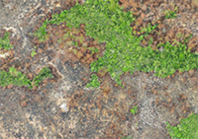
Mapping Hong Kong’s vegetation fire history
New ‘LTS fire pipeline’ reveals unprecedented detail
A study by PhD student Aland Chan and colleagues at the Conservation Research Institute has developed a new way of mapping and representing fire occurrence in natural vegetation in Hong Kong, China, forging the basis for a new monitoring system that fire ecologists can apply throughout the wet tropical regions of the globe.
Researchers combined data from the widely-used Landsat system with new approaches to create and test more detailed and accurate fire maps covering many decades, using a system they dub the ‘LTSfire pipeline’.
‘The main difficulty in mapping using remote sensing is the high cloud cover and rapid post-fire recovery in wet biomes. It is not uncommon for burn areas to only be discernable in one or two partially cloudy images captured before the site revegetated. Another issue is varying haze and light conditions, causing the colours to change from image to image. It took us a lot of effort to find a way to uniformise the images such that the models don’t get thrown off by oddly-coloured images’, said Aland Chan, lead researcher and author of the paper.

After collating their input data, including the relevant Landsat imagery and training/validation datasets, the group pre-processed the Landsat scenes into seasonal date-traceable composites before extracting training data from the composites to build random forest regression models based on time elapsed after the fire. These were used to identify areas that resembled burn areas, and the burn severity of these detected burn area pixels estimated by time series-relativized burn ratio.
The resulting maps are the first Landsat-based burn area (BA) maps in wet tropical / subtropical Asia that cover the entire Landsat 5/7/8 time series. They are also the first long-term Landsat BA map in the wet tropics/subtropics that estimated both BA detection dates and burn severity.
‘By deforesting much of the landscape and introducing ignition sources, humans have fundamentally transformed the fire regimes in the wet tropics. There is currently a lot of momentum in restoring these degraded sites, but there is still a lot of uncertainty in how fires interact with these forest restoration projects. We are currently trying to work out the differences in fire susceptibility between different vegetation types and model how fires behave in these wet tropical systems.’
These full decadal 30m resolution BA maps provide finer temporal and spatial resolutions than previously achieved in the wet tropics, and will be very valuable for future fire ecology and management studies.
‘By providing detailed information on thousands of burn areas over many decades, developed via our new methodology, these maps will help bridge the gaps between remotely sensed and field data, and provide a new basis for our understanding of tropical fire ecology,’ concluded Aland.
View 34 years of vegetation fires in Hong Kong in the timelapse video below:
Please allow social and marketing cookies to show embedded content.
Read the paper:
Chan, A.H.Y, Guizar-Coutiño, A., Kalamandeen, M., and Coomes, D.A. (2023). Reconstructing 34 Years of Fire History in the Wet, Subtropical Vegetation of Hong Kong Using Landsat. Remote SensingDOI: 10.3390/rs15061489
More information: