Submitted by Helen C. Scott on Fri, 27/11/2015 - 09:58
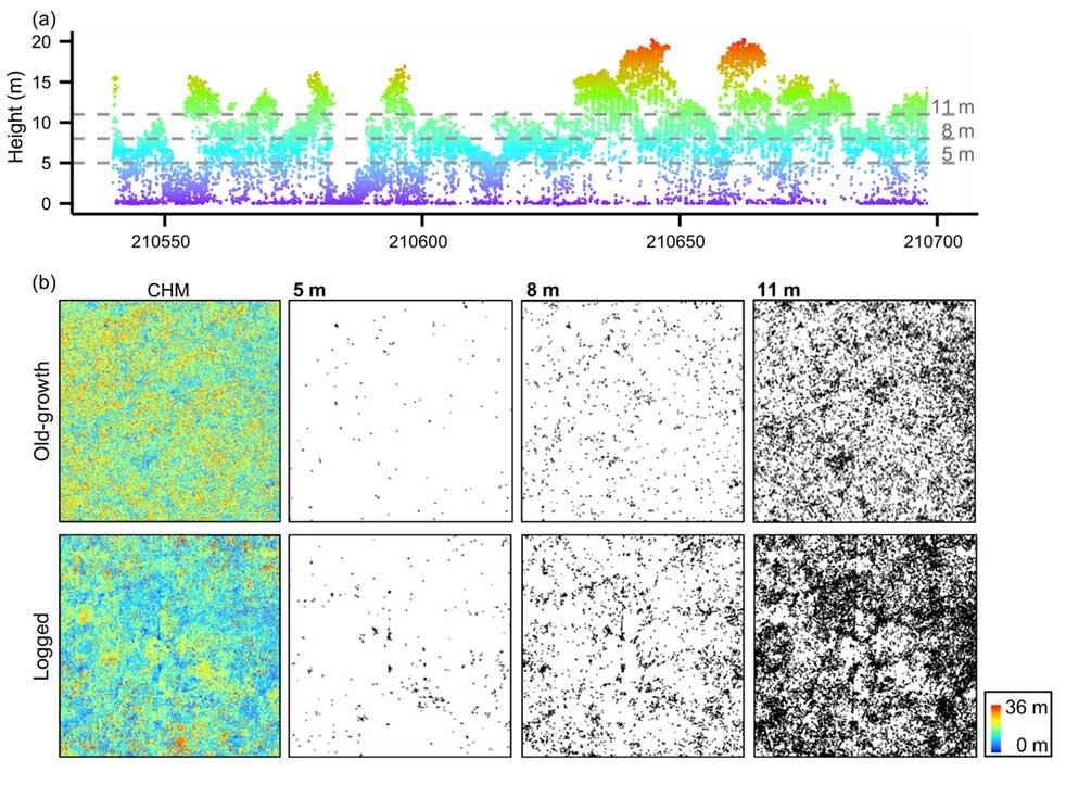
Béatrice Wedeux and David Coomes published a paper in Biogeosciences analysing how environmental factors and selective logging interact to shape the canopies of tropical forests. Using airborne laser scanning technology across a 750 km2 peat swamp forest landscape in Borneo, the study reveals strong shifts in canopy height and gap patterns along a fertility gradient linked to changing peat depth. In areas where logging roads were detected on historical satellite imagery, the canopy is lowered and has larger gaps, especially so on deep peat where tree growth is thought to be limited by low nutrient availability and waterlogging. The study identifies a close link between the height and the gap structure of tropical peat swamp forests at the landscape scale and reinforces the vulnerability of this ecosystem to human disturbance. The degradation of tropical peat swamps will be at the heart of upcoming climate negotiations in Paris, as emissions from fires in Indonesian peatlands over the last couple of months – exacerbated by a dry El Niño spell - approach the total annual emissions of Brazil (1.62 billion metric tons; www.wri.org).
- Read online: Wedeux, BMM and Coomes DA (2015) Landscape-scale changes in forest canopy structure across a partially logged tropical peat swamp, BIOGEOSCIENCES 12(22):6707–6719, DOI: 10.5194/bg-12-6707-2015.